Think Global. Act in Ártúnshöfði.
LTH - Sustainable Urban Landscape - 2021

Bird’s Eye View over the area
In the second semester of my Master’s Programme “Sustainable Urban Design”, we worked on a site in Ártúnshöfði, Reykjavik.
The course was divided in different phases: Analysis (both on a regional and local scale), Vision, Strategy and the Individual Design. The aim was for us to first identify the potentials and challenges on a regional scale and make a proposal for those on the local scale, with special consideration to the breathtaking landscapes Iceland has to offer.

Current Situation
Ártúnshöfði stretches out on an area of around 0.9 km2 and is located in the district Grafarvogur in the southwest of Iceland. It has a strategic location as it is close to the water as well as to the city center of Reykjavik which is in a distance of around 6km. Even though Ártúnshöfði nowadays mainly is characterized by car-related functions, retail or light-industry, the nature reserve Ellidaárdalur which is in the south of the area and Geirsnef, which is today mostly used as a park to walk the dog offer important green structures and a rich biodiversity. However, the highway “Vesturlandsvegur” in the south of the area currently separates the area from the nature reserve and creates both air and noise pollution. Due to previous industrial activities on the site as well as landfill that has taken place, the soil of the area might be contaminated. Another challenge is the flooding danger that will have to be considered when developing the area.
(Photos by Ása K. Bjarnadóttir)
Regional Strategy

Regional Strategy 1:10000
The wooden path along the ring road connecting the site to the surrounding districts, the ecoduct allowing a continuous green network as well as the BRT allowing polycentrality in Iceland.
Design

Masterplan 1:2000

Ártúnshöfði becomes a pioneer for sustainable development and community living in Iceland
Relating to the five big challenges (Tourism, Car-Use, Population Growth, Missing Public Spaces, Urban Sprawl) I have decided to tackle with my proposal, all the foreseen projects are related to the main vision of Ártúnshöfði becoming a pioneer for sustainable development and community living in Iceland, attracting and teaching tourists from all over the world and influencing how they will treat Iceland on their stay.
Another lighthouse project will be the Ecoduct connecting the area to the nature reserve in the south and minimizing the effect of “Vesturlandsvegur” in the south that is passed by more than 100.000 cars every day. This will improve the whole region as this green connection will be a missing link for the Green Belt the municipality of Reykjavik aims for and will make it possible for wild life to cross the heavily trafficked highway. To meet the housing needs of the growing population, “Think Global – Act in Ártúnshöfði” will propose density, however not exceeding 5 storeys and working with the varied topography to keep the existing sightlines on the site. A porous courtyard is proposed as a hybrid of different existing and liked typologies in Iceland. When designing the dwellings, special attention was given to make them suitable for the harsh weather conditions and maximizing the solar access by orientating them towards North-South if possible. Moreover, single-sided gable style as a roof is preferred to protect the buildings from the weight of the snow.
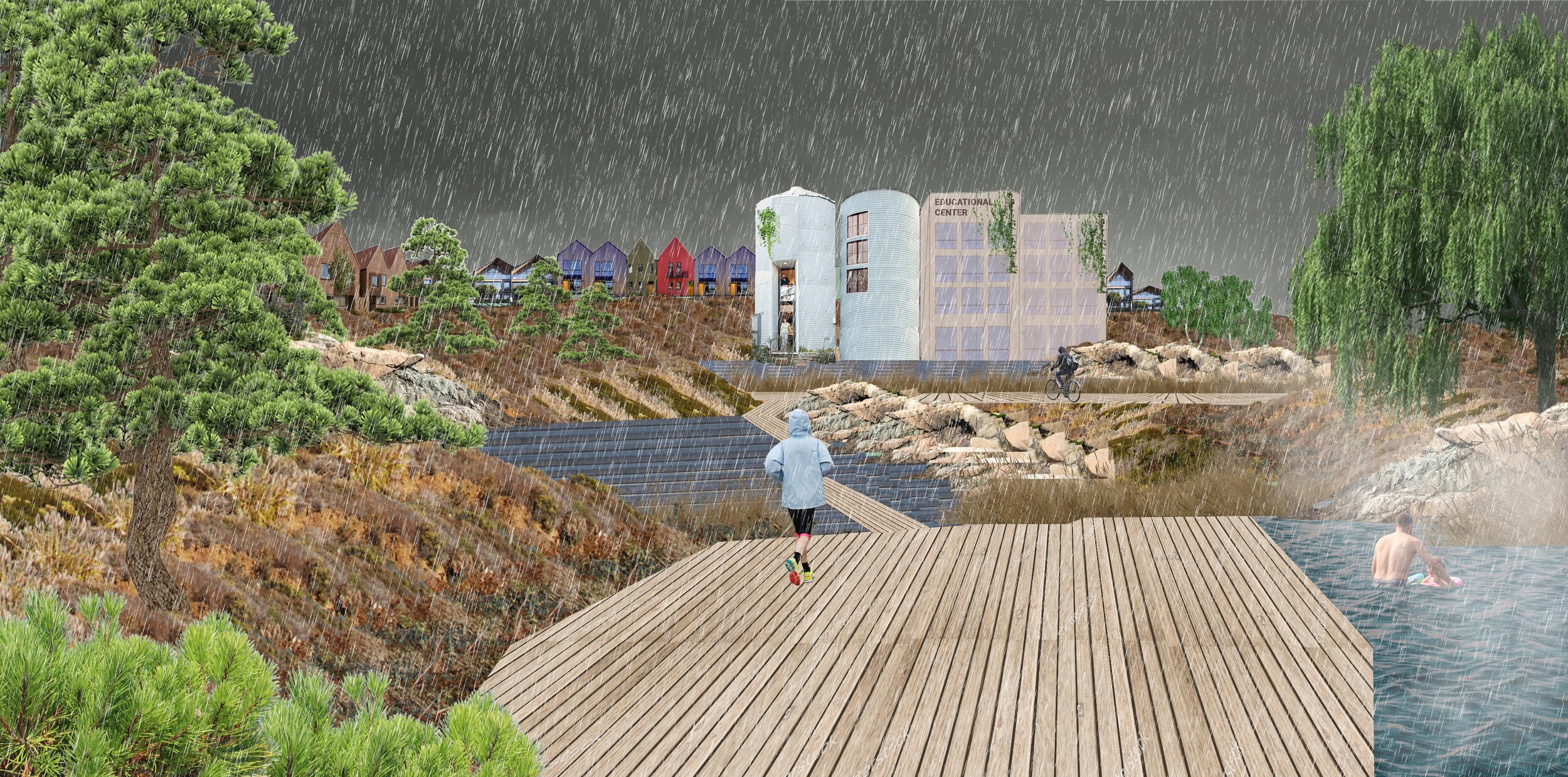
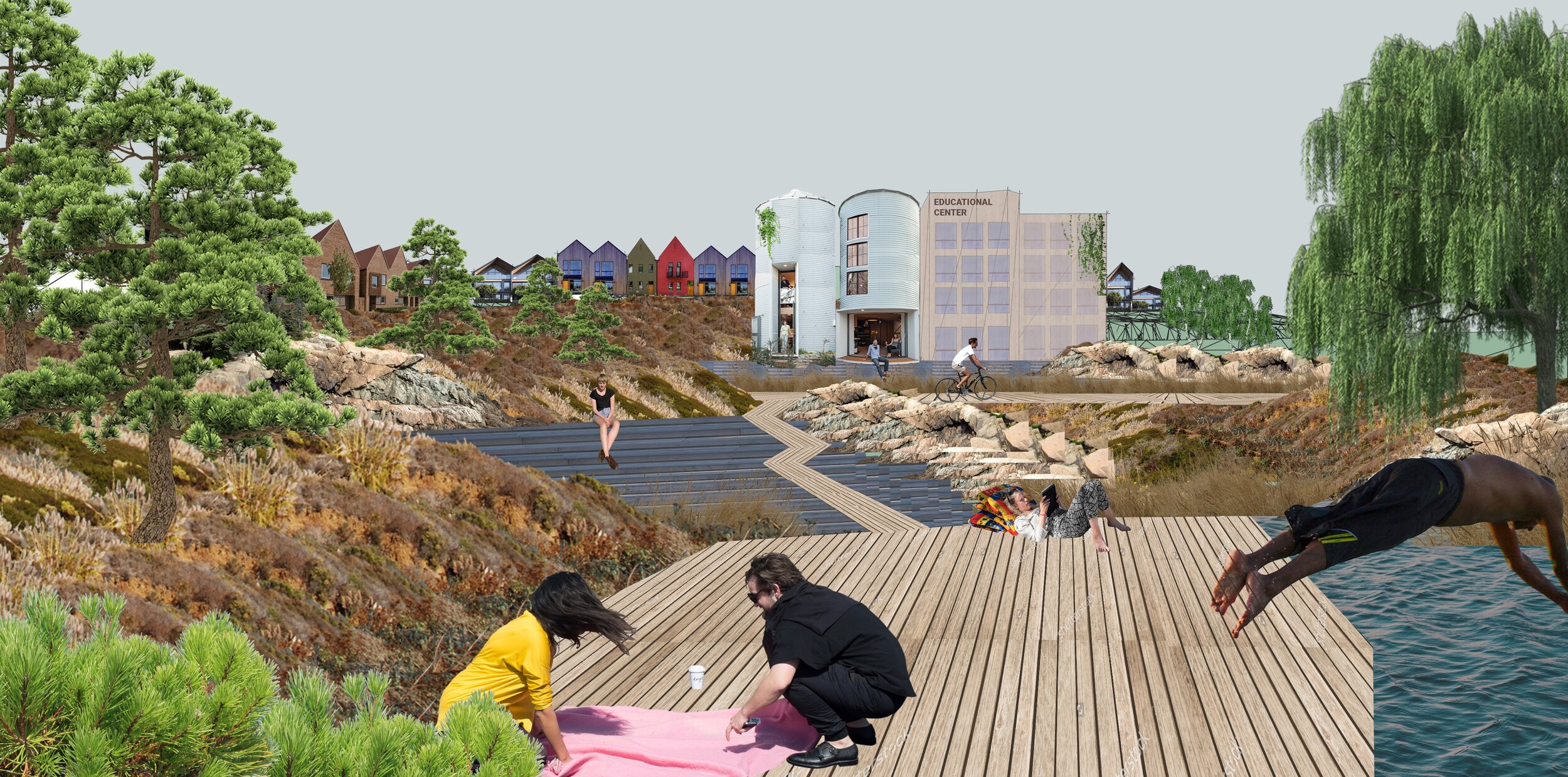
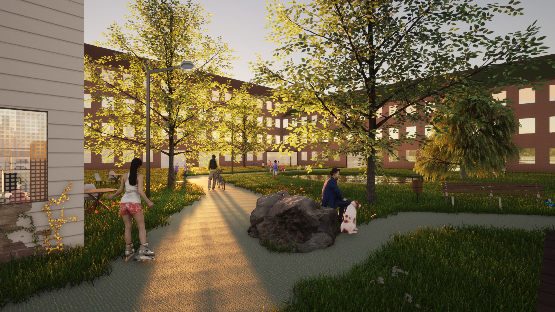
A New Public Space in Ártúnshöfði
As there will be a wooden path leading through Ártúnshöfði, not only tourists, but also locals will use it to discover the new innovative district by foot or bike. This path will also cross one of the main public spaces by the new public path and sauna situated at the bay of the area.

The deck fits itself into the existing landscape

2021

2025
Fostering Climate Smart Urban Design
Considering Climatic aspects there’s a lot we can learn from traditional Icelandic Housing, but let’s make them fit for the future needs! I plan single-sided gable style roofs to protect it from weight of snow, North-south orientation when possible, Solar panels towards south and green roofs to decrease runoff.


Mind the topography
The varied topography has of course played a huge role when designing the buildings and deciding on their heights. The main principle was to keep the sight axes and make sure that there's a maximum access to sun. When looking at the Zoom In, one can see how the elevation will make the site look very varied even though the courtyards are quite uniform.


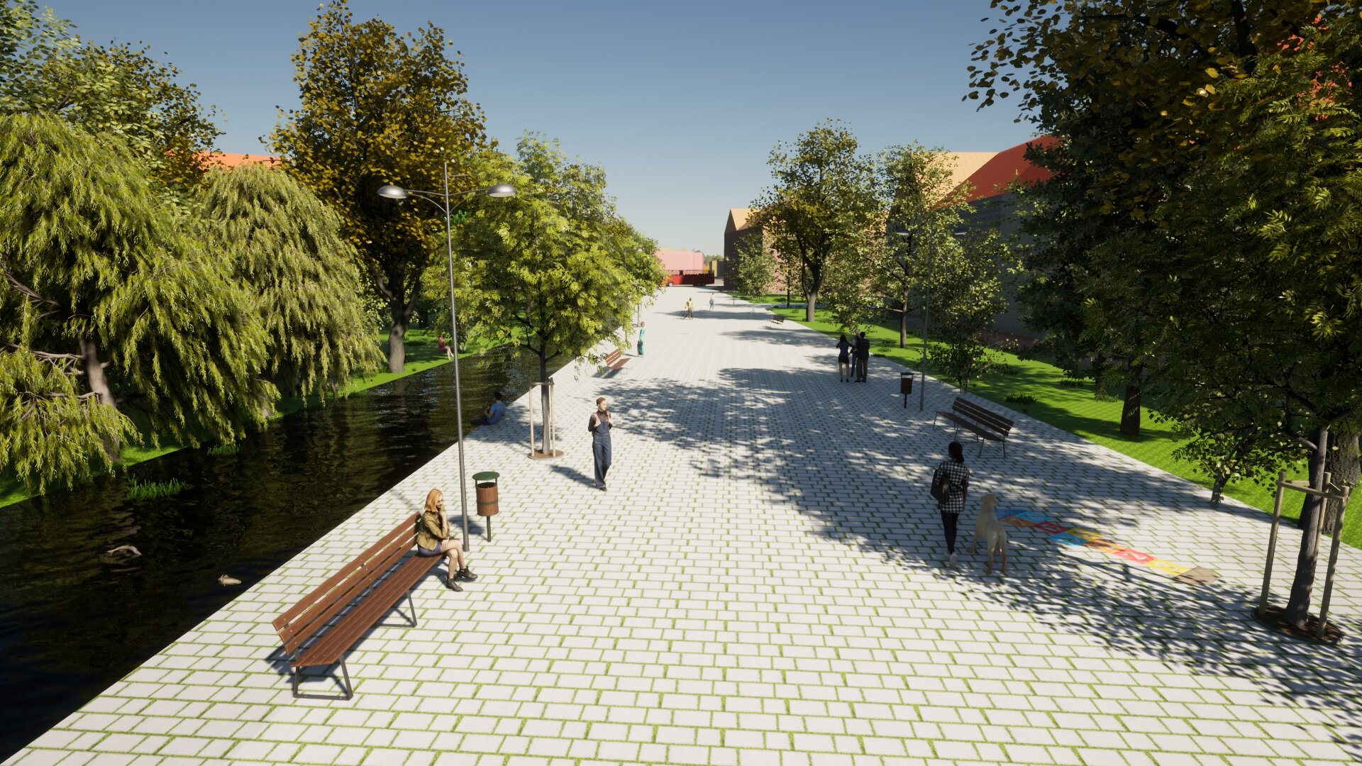
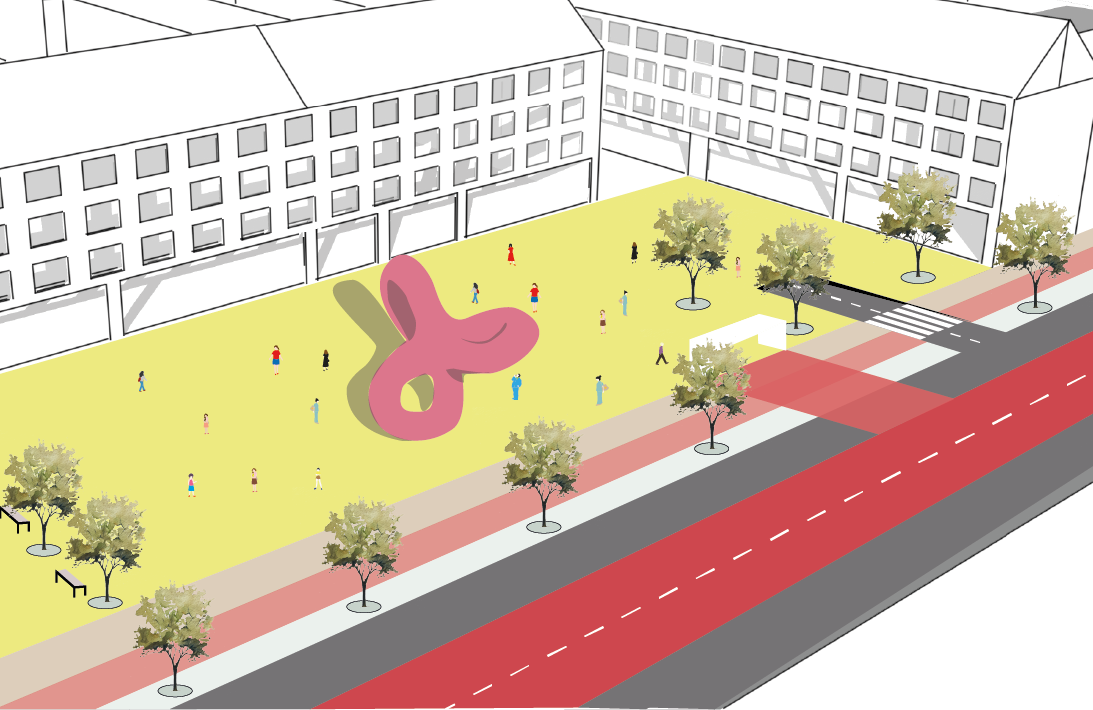
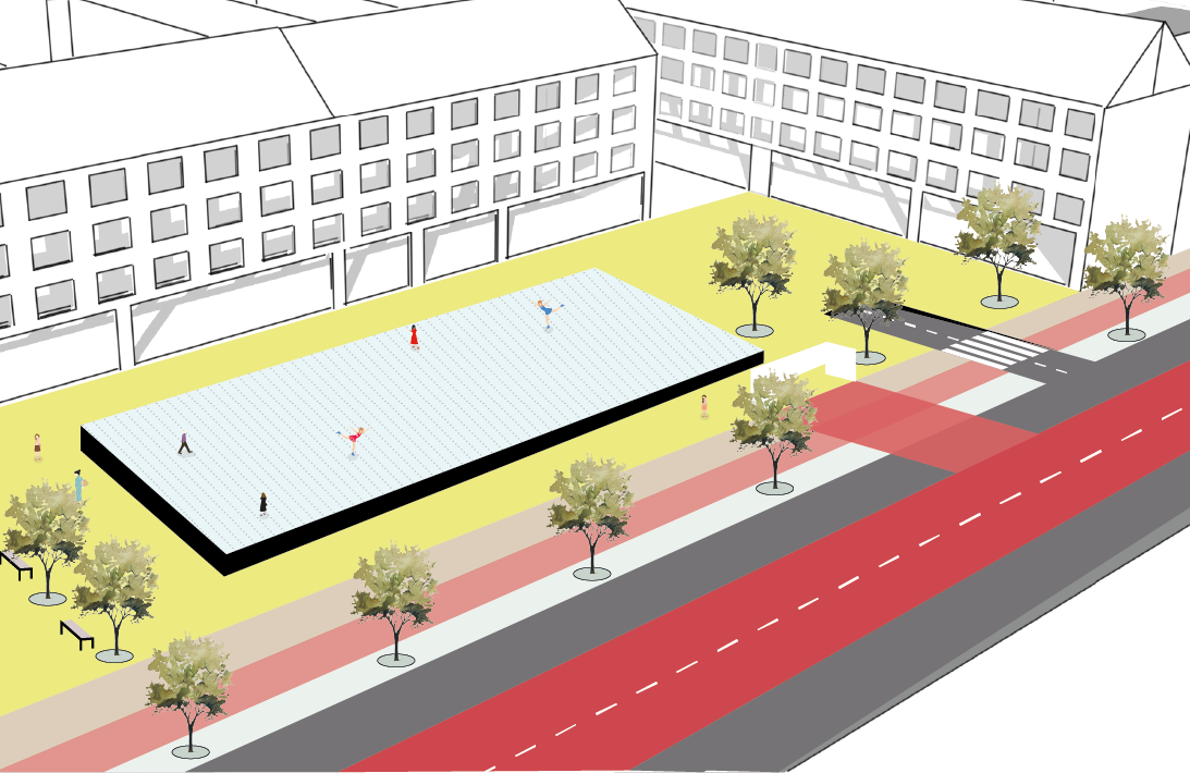
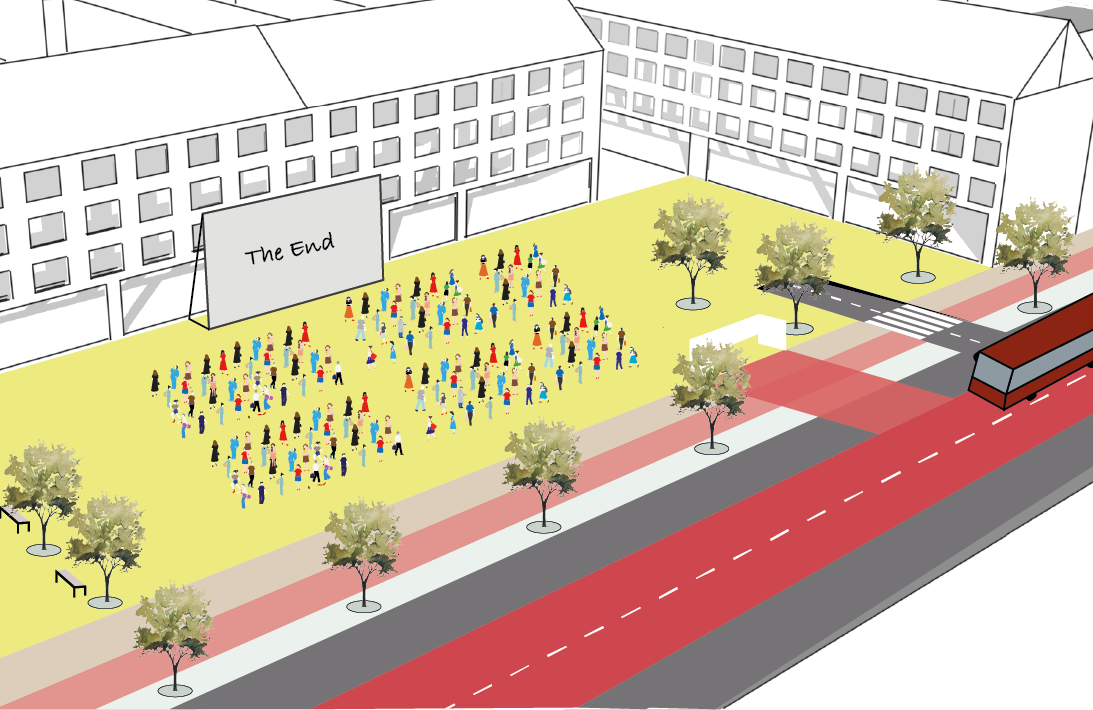
Main Square at the BRT stop
The main square - which is located at one of the BRT stops - offers enough space for a variety of uses throughout the year. Underneath, a parking garage is foreseen. One of the strategies of the project is to provide parking options right at the BRT stops and only permit driving by car along the main road. The aim is to thereby increase the number of people using non-motorized traffic and the BRT. As the people will have to walk anyways (max 5 minutes to each stop) they therefore might as well use the public transport system instead of their car.


Zoom-In main square

Section main square